I.2.4 The gaps
Actually we know about the two land registers (Urbar) of the dominion Rannariedl from 1488 and 1509 and the one of the dominion Falkenstein from 1537.
In 1488 we can not identify any place called Hutstein at all, while in 1509 there is already someone paying taxes for a fief there (Thomas Hutsteiner). So, the farm at Hutstein was erected between 1489 and 1508 which marks a 20 years gap in which we do not know what happened there and when did it happen.
The land register from the dominion Falkenstein starts in 1537. We have Hanns working on a farm at Hutstein and paying taxes. Now we have a gap of about 30 years compared to the Rannariedl land register of 1509. So, the question is: could it be, that his farm was erected much earlier than Thomas’ farm, because there is no older Falkenstein document?
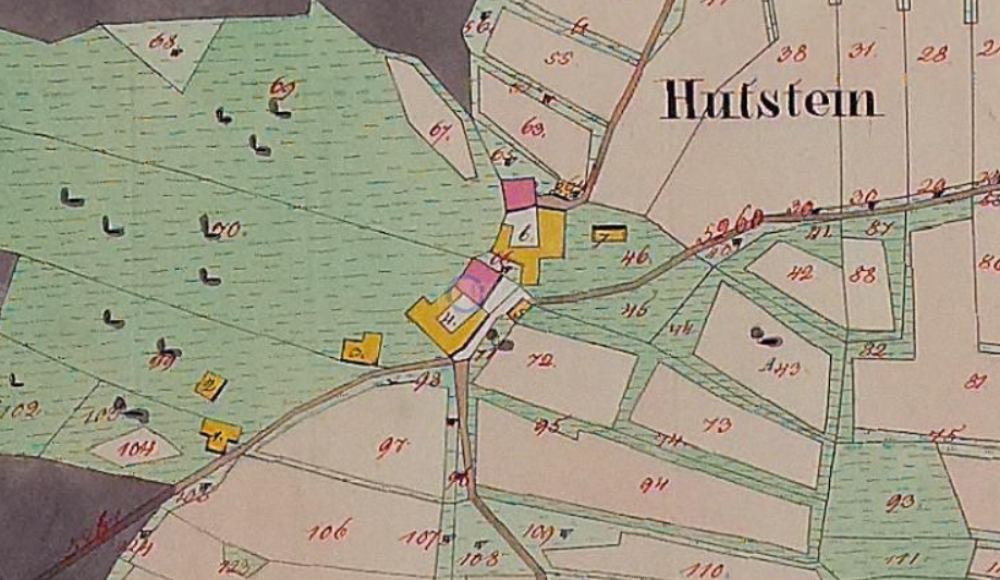
To my mind not. If we use the cadastre map of 1828 it is visible that the only road to next village (Vatersreith) directly connects to one of the farms’ residential house, and obviously it was prolonged later to the second one. And we identified this, the first farm as the Rannariedl farm, the Themel Hutsteiner farm.
So, taking the course of the road into account we can state that the Falkenstein farm was erected after 1488, too, and after the Rannariedl farm, i.e. between 1489 and 1536.